Vacation 2001
Note: Maps (there are 4) can be opened by clicking on Map at the top and bottom of each page.
The Map will be in it's own window so you can leave it open while reading. On
all maps, the northern track is the homeward bound track.
![]()
This year's vacation was a camping trip across the United States, into northwestern Canada. Our goal was to drive to Inuvik, in the North West Territory, which is as far north as you can drive in Canada.
So, with that goal in mind, off we go. Our first day was spent on I-80. We stopped for the night in Des Moines and had a very nice visit with Gail's cousin, Carol Brown, her husband George, and two of their grandchildren. The next day, we drove over to Omaha and had lunch with a friend of many years, Marty Magee (notice how carefully we avoid the word old these days). After lunch we met up with Brent Worms and his wife Micki. We went a short distance out of Omaha and camped that night at Summit Lake Recreation area. This turned out to be an almost empty campground, probably because they were emptying the lake in order to get rid of some unwanted occupant of the lake.
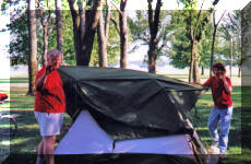
After Nebraska, we moved up into South Dakota and camped at Lewis and Clark Recreation Area on the Missouri River. here is a picture of Brent and Micki setting up their tent there.
 Staying in South Dakota, the four of us drove over to
Custer State Park, in the Black Hills of western South Dakota. This is
where we first started seeing some interesting wildlife. First there were
the Prairie Dog towns and then when we got to the park we saw Bison
 and Bighorn Sheep
 .
We spent several days in this park, just relaxing and doing very little.
We were going to go canoeing on this pretty little lake near our campsite, but
decided it was too cool and the chance of thunderstorm was too high.
Fortunately for the photographer in me, not everyone felt that way.

Brent and Micki headed for home from
Custer and we continued west. As we were driving across Wyoming on highway 14A,
we saw a sign for a Medicine Wheel so we stopped to see it. Wasn't
easy. First we had to drive up a narrow, dirt road for three miles, then
walk another mile and a half. This at an elevation over 9000 ft (our
highest point on the whole trip, by far). Shown here is part of the
walk.  Medicine Wheels were fairly common in the area now known as the United
States. There are a lot of different explanations for them and Gail says
some day she is going to find the right student and they will pull all the
legends together and publish a book (article?) on the subject. Having said
that, what is known is that Native People use them as a sacred place and in fact
we saw one Sioux family there doing just that. Medicine Wheels are made
with rocks laid out in a wheel pattern as the name implies.
 Pictures of these things, which are about 50 feet in diameter, are best taken
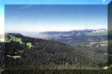
from the air. As I said, we were up high and the views were great.
